Where is Mérida Mexico on the Map? A Local’s Guide
Mérida doesn’t get the name recognition of Tulum, Playa del Carmen, Cabo San Lucas, Cancún, or Puerto Vallarta — so most people planning a first trip down here are wondering, where is Mérida Mexico on the map?
I’ll show you exactly where Mérida sits in the country, what surrounds it, and the few navigation quirks I wish someone had explained to me before I moved here in 2019. By the end, you’ll have your bearings.
Where is Mérida Mexico on the map? The quick answer
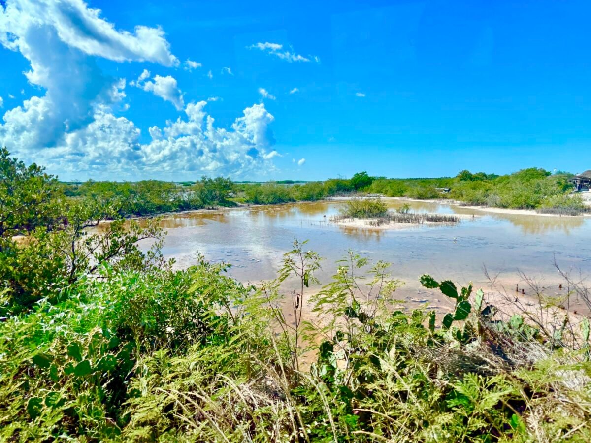
Mérida is the capital of the State of Yucatán, on Mexico’s Yucatán Peninsula — the thumb of land that separates the Gulf of Mexico from the Caribbean Sea. It sits about a 3-hour drive west of Cancún, roughly 22 miles inland from the Gulf coast.
With a metro population approaching 1.2 million, it’s the largest city on the peninsula and the cultural heart of the region.
📌This article was originally posted on October 30, 2020 and now updated in 2026 with new regulations and details.
The Yucatán Peninsula in context
The Yucatán Peninsula contains three Mexican states — Yucatán, Quintana Roo, and Campeche — plus parts of Belize and Guatemala. Quintana Roo gets most of the international attention because that’s where Cancún, Tulum, and Playa del Carmen sit, drawing millions of tourists every year to the Caribbean coast.
Mérida is on the opposite side of the peninsula — quieter, older, and far less tourist-driven. That’s a big part of its appeal. Once you find where is Mérida Mexico on the map, you’ll see why people who visit both coasts often end up choosing Mérida.
How Mérida is laid out
The center of the city is fairly easy to navigate once you understand the numbered grid the Spanish colonists laid down centuries ago. A handful of larger through-streets carry actual names — Paseo de Montejo, Avenida Cupules, Avenida Itzáes, Avenida Colón — but the rest are numbered.
The grid works like this:
- Larger, even numbers begin in the west and reduce as you travel east.
- Larger, odd numbers begin in the south and reduce as you travel north.
Plaza Grande, the historic city center, sits between Calle 60 and 62, and between Calle 61 and 63. Memorize those four numbers and you’ll always know your distance from the heart of the city.
News flash
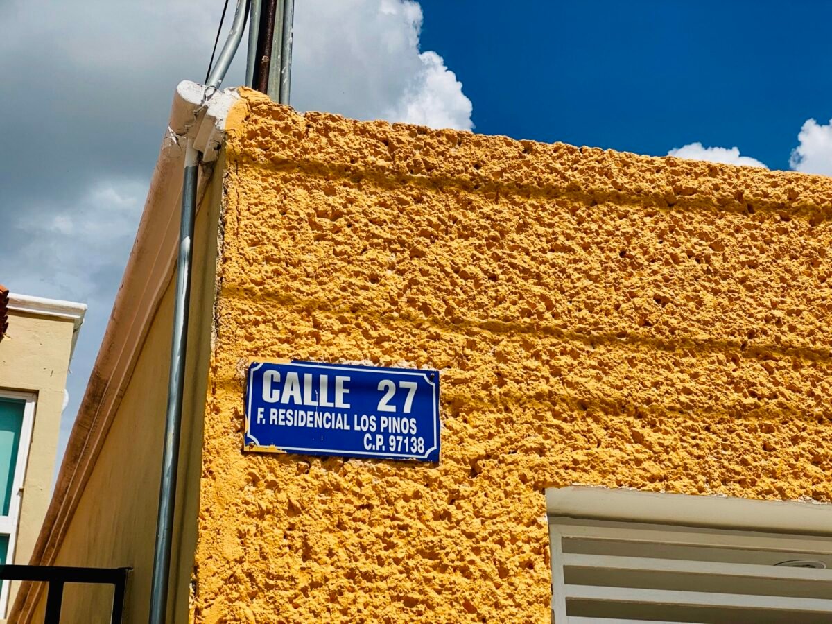
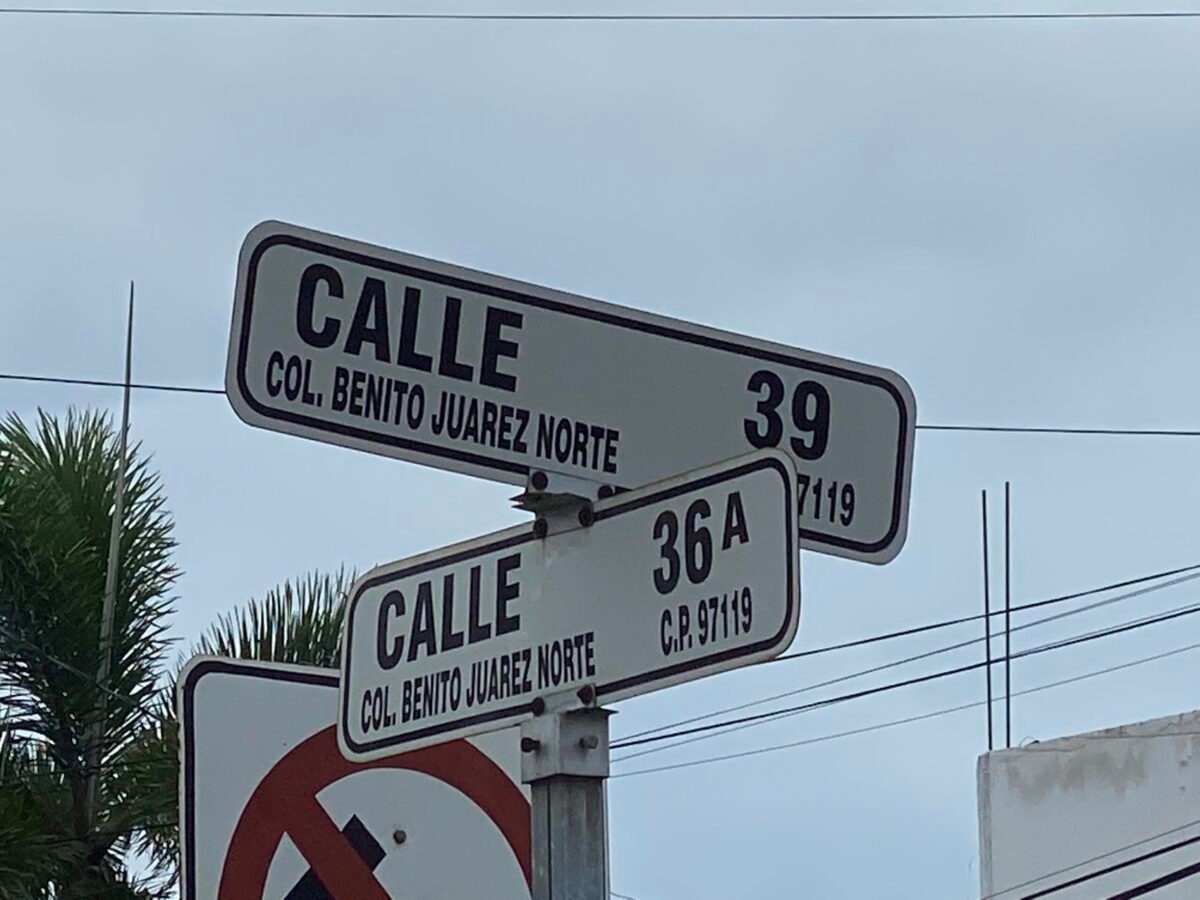
Here’s the trap that catches every newcomer: each neighborhood has its own set of address numbers. There’s a Calle 41 in Centro, another Calle 41 in García Ginerés, another in México Norte, and so on. They are not the same street.
To avoid ending up in the wrong colonia, always use the cross streets AND the zip code when you’re navigating.
Reading a Mérida address
A typical address looks like this:
Calle 41 559 x 80 y 82, Centro 97000
Here’s what each piece means:
- Calle 41 — the street
- 559 — the house number
- x 80 y 82 — x means “between” Calle 80 y (and) Calle 82
- Centro 97000 — the neighborhood and zip code
You need all three parts — street, cross streets, and zip — to land at the right door. Occasionally you’ll also see letters mixed in (Calle 41-A, for example), which is its own neighborhood within a neighborhood.
If you can’t find the exact number, just keep walking a block or two. House numbers don’t always run consecutively, and I promise you’ll eventually find it.
Navigation tips for getting around
A few things that will save you time:
- One-way streets are common. Watch for the arrows on street signs, or look at how the parked cars are facing — that’s usually your clearest clue.
- Street signs list both the neighborhood and the zip code. Centro signs just say “Centro.” Others will read “Col. García Ginerés 97070” or “Col. Yucatán 97115.”
- The Periférico is the city’s outer loop. It circles all of Mérida and is your best landmark for orienting yourself to any neighborhood.
- Paseo de Montejo is the major north-south avenue. Modeled on the Champs-Élysées by 19th-century sisal barons who hired Parisian architects, it’s the most visually iconic street in the city.
Las Esquinas de Mérida (the corners of Mérida)
This is one of my favorite quirks of the historic center, and it’s worth knowing about before you arrive.
When the Spanish colonists laid out their numbered grid, residents found it confusing to meet at intersections like “36 and 61.” So they did what people have always done — they used landmarks. Churches. Parks. Eventually, individual street corners.
Almost every corner in the historic center was given its own unique name, marked by an iconic red-and-white plaque featuring the name and a drawing. Even residents who couldn’t read could find their way to “La Sombra” (The Shadow), “La Sirena” (The Mermaid), or “El Besito” (The Little Kiss).
In 2012, a British researcher named Bruce Edmiston spent a year documenting the surviving plaques and the stories behind them. A few of my favorites:
- Dos Camellos (Two Camels) — named for two Arab merchants who arrived on camelback to run illegal trades from the corner shop.
- El Degollado (The Cut Throat) — a heartbroken barber who took his own life when his lover left him for the governor.
- El Mono Suelto (The Free Monkey)
- El Autogiro — named for the autogyro, a kind of unpowered rotorcraft
Most of the plaques you’ll see today are replicas, but a handful of colonial-era originals are still in place. Looking for them while you walk Centro is a small treasure hunt I never tire of.
What Mérida feels like once you’re here
Knowing where is Mérida Mexico on the map is one thing. Knowing what the city actually feels like is another.
The historical center has received a UNESCO makeover — swept cobbled streets, manicured Plaza Grande gardens, restored colonial mansions along Paseo de Montejo. On any given day, you’ll find free live music in the town square, horse-drawn and electric carriages clicking through the streets, and street vendors selling marquesitas and esquites.
What surprises most first-time visitors is who’s riding those carriages: more Mexican families than foreigners. Mérida hasn’t been overrun. That’s a deliberate choice the city has made, and it’s part of what keeps the place feeling like itself.
For where to eat once you’re here, I’ve put together a full guide to the best restaurants in Mérida.
Final thoughts on where is Mérida Mexico on the map
Once you have these basics, getting your bearings is quick. A short checklist for your first day:
- Find the Periférico — the outer loop tells you where the city ends.
- Locate Centro and Plaza Grande — your downtown reference point, between Calles 60/62 and 61/63.
- Spot Paseo de Montejo — the main north-south avenue.
- Identify your colonia — figure out where you’re staying in relation to those three landmarks.
- Use Google Maps liberally — it works well here, and it’ll save you from accidentally walking into the wrong Calle 41.
That’s it. Knowing where is Mérida Mexico on the map, plus those five reference points, is genuinely enough to navigate this city with confidence.
If you’d like more context on what life here is actually like — neighborhoods, costs, the small daily things nobody writes about — join my online community. I’d love to have you.